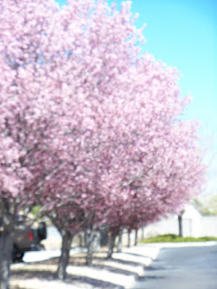
This is called a purple leaf plum. It is an ornimental tree with no fruit. I don't have any like this. I found some beauties downtown so stopped to take some photos.
The most beautiful thing we can experience is the mysterious. It is the source of all true art and science. ------Einstein, "What I Believe"
Tuesday, November 15, 2011
Purple Leaf Plum Tree
This is called a purple leaf plum. It is an ornimental tree with no fruit. I don't have any like this. I found some beauties downtown so stopped to take some photos.
Monday, November 14, 2011
Owachomo Bridge, Newspaper Rock, Goosenecks State Park

Staying in Blanding, Utah tonight. After a day filled with sunshine, spotty rain, occasional snow showers, and some pretty good dust storms (not to mention some REALLY cool clouds throughout the day), I caught a nice sunset over Owachomo Bridge at Natural Bridges National Monument. Was hoping to photograph some stars over the same bridge, but it was too cloudy.

Some other highlights from today: Stopped by Newspaper Rock in Canyonlands National Park, an amazing rock which has probably the highest concentration of petroglyphs of any single rock in the Southwest. I also drove through some intense rain today, followed by some amazing skies as the storm broke up. As I drove North from Monument Valley I took a quick side trip to Goosenecks State Park to photograph the sky above the bends in the San Juan River.

Saturday, November 12, 2011
Light at the end of the tunnel?
A good deal of my time so far this summer has been consumed with scanning pictures and preparing pictures for scanning. On June 2nd I reported that another 970 pictures had been scanned since mid-May, plus the 575 pictures of mom's that had been scanned in April.
For the heck of it, I decided to keep track of how much time was spent in scanning. In hindsight I probably should have tracked how much time was spent in preparing the pictures for scanning as well. Once I started on the magnetic albums, it's highly likely that as much time was spent in prep as in actual scanning.
The prep work consisted of removing the pictures from the albums, sorting them into the order in which they were to be scanned, then attaching them to archival paper. After fiddling with trying to put multiple pictures on the scanner bed and getting irritated with them moving when the cover was lowered (due to static), I decided to put the pictures on the pages where I wanted them, add captions as needed, then individually scan the pictures along with their corresponding captions. Too bad I didn't think of that when I was scanning mom's first album. Something to keep in mind for the next one!
Out of the past 48 days, scanning was done on 21 of them, usually 2-3 hours a day but occasionally 4 hours. One day I was on a roll and spent 6 hours scanning! I'm not totally crazy, it wasn't all at one sitting. I did get up a few times to stretch my legs and grab a bite to eat. And yes, I washed my hands after eating and before handling the pictures! Anyway, a total of 70 hours of scanning in 21 days netted another 2278 images. That's an average of 3.3 hours and 108.5 images per day.
That takes care of my personal albums. There are still a few more of Mom's to do. Next up will be the genealogy documents. But, they too need to be sorted prior to scanning. I've mentioned before that with my filing system I put documents of the same type together, regardless of who they are for, whether an ancestor or other relative, giving each document a number. I could find them easily because of the numbering system and the fact that when something was entered in my database the document number was entered for reference, so all I needed to do was look up the person in the database to see where the document was filed. But that system isn't really intuitive and I need to make it easier for whomever will take over my research (assuming there is a family member who wants it or in case it gets donated to a library or society). So that means sorting and putting the documents together for a given person or family. I haven't decided yet whether I'll scan "everything" or just the ancestral documents. "Everything" includes a lot. I think, after I've sorted through stuff I'll do the ancestors first and save the rest for another time. I want to get back to researching! And doing other things. But at the least, I want to get the ancestor documents scanned.
There may not yet be light at the end of the tunnel, but it will be there one day. Soon, I hope.
The picture below was taken in September 1978 while I was stationed in Japan. Above the Clouds. Sunrise from the top of Mt. Fuji. There is a story to tell that goes along with the picture, but it'll have to wait for another time.
Photo Copyright © 1978/.. by Rebeckah R. Wiseman
For the heck of it, I decided to keep track of how much time was spent in scanning. In hindsight I probably should have tracked how much time was spent in preparing the pictures for scanning as well. Once I started on the magnetic albums, it's highly likely that as much time was spent in prep as in actual scanning.
The prep work consisted of removing the pictures from the albums, sorting them into the order in which they were to be scanned, then attaching them to archival paper. After fiddling with trying to put multiple pictures on the scanner bed and getting irritated with them moving when the cover was lowered (due to static), I decided to put the pictures on the pages where I wanted them, add captions as needed, then individually scan the pictures along with their corresponding captions. Too bad I didn't think of that when I was scanning mom's first album. Something to keep in mind for the next one!
Out of the past 48 days, scanning was done on 21 of them, usually 2-3 hours a day but occasionally 4 hours. One day I was on a roll and spent 6 hours scanning! I'm not totally crazy, it wasn't all at one sitting. I did get up a few times to stretch my legs and grab a bite to eat. And yes, I washed my hands after eating and before handling the pictures! Anyway, a total of 70 hours of scanning in 21 days netted another 2278 images. That's an average of 3.3 hours and 108.5 images per day.
That takes care of my personal albums. There are still a few more of Mom's to do. Next up will be the genealogy documents. But, they too need to be sorted prior to scanning. I've mentioned before that with my filing system I put documents of the same type together, regardless of who they are for, whether an ancestor or other relative, giving each document a number. I could find them easily because of the numbering system and the fact that when something was entered in my database the document number was entered for reference, so all I needed to do was look up the person in the database to see where the document was filed. But that system isn't really intuitive and I need to make it easier for whomever will take over my research (assuming there is a family member who wants it or in case it gets donated to a library or society). So that means sorting and putting the documents together for a given person or family. I haven't decided yet whether I'll scan "everything" or just the ancestral documents. "Everything" includes a lot. I think, after I've sorted through stuff I'll do the ancestors first and save the rest for another time. I want to get back to researching! And doing other things. But at the least, I want to get the ancestor documents scanned.
There may not yet be light at the end of the tunnel, but it will be there one day. Soon, I hope.
The picture below was taken in September 1978 while I was stationed in Japan. Above the Clouds. Sunrise from the top of Mt. Fuji. There is a story to tell that goes along with the picture, but it'll have to wait for another time.

Carolus and the Clerk

This photo was taken in 1988, at the Chicago Botanical Garden in Glencoe. I haven't been there in some time, and don't know how it looks today, but back then my younger children loved the intricate details and large three-dimensional quality of this portrait of Carolus Linnaeus. On every visit, and there were many, we walked around it, trying to identify the individual leaves and flowers that were sculpted and blended together to form his image. Today, the 300th birth anniversary of Linnaeus is being celebrated not only in Sweden, but in the hearts of gardeners and scientists all over the world.
This day is also the birthday of a modern gardener, the wonderful, intricate and three-dimensional Hank the County Clerk - if you have a chance to read some of his essays on Linnaeus [make that essays that use Linnaeus as the jumping-off point for many thoughts!] you will be amazed. Here's a link to Linnaeus, Son of No Man.
Happy Birthday, Hank... and Carolus, we do not forget you.
Friday, November 11, 2011
Northward Bound
Tuesday, April 19th - - After four lovely days of visiting friends in northeast Louisiana, I headed north on Sunday morning (April 17th). My goal was to get back to Indiana without traveling on Interstate Highways at all and to avoid four-lane highways as much as possible. That I have done thus far but I'm only halfway there!
I stopped at the Civil War Interpretive Center in Corinth yesterday (a post is forthcoming on that visit). Last night I stayed at this beautiful State Park in Mississippi – the Natchez Trace Parkway runs through it – and got on the Parkway this morning.

My campsite alongside the lake at Tishomingo State Park in northeast Mississippi.

The sun had been hidden by heavy clouds all day but showed itself for a few minutes late in the evening.


I just love the “green” all around. Delightful. And easy on the eyes.
Thursday, November 10, 2011
Wednesday, November 9, 2011
Icicle River Gorge Trail ..
Jennifer and I finally got away for a little camping/hiking trip. We drove out to Leavenworth to camp with Matt and his brother Sunday night, and it turned out they had a similar plan for Monday. As Matt put it, "Drive to the end of the road and start walking." I was not aware that Icicle Road was still not fixed, so we headed onward. About five miles from Eight Mile Campground we were met with the road closure.
The road now a river
There was a newer road cut away from the river, but the forest service is not allowing public access by motorized vehicles at this time, so we parked and started walking. The new road is not yet ready for heavy vehicle access and is even susceptable to some flooding early on, where a small bit of rocks and mud is the only thing keeping the river out. It also showed plenty of signs of beavers, which might interfere with the road as well. We hiked on this a bit before it rejoined Icicle Road above the washout. We investigated the upriver side of the washout before proceeding up the road.
The work of beavers
After a while we came to the Chatter Creek trail head. After checking out the board there, (A trail conditions report from August '08 was on it.) we parted ways. Matt and his brother were heading back to Seattle via Washington Pass and Jennifer and I forged on ahead. Just around the corner we found the Chatter Creek Ranger Station. It looked like it was in a state of disrepair, but not too bad considering it has not been used in two years. Just across the road was the start of the Icicle River Gorge Trail. We decided to take it.
Unfortunately, the most dramatic point on the trail is the start where you cross the footbridge over the creek.
View from the bridge
There was some serious whitewater and interesting eroded rock in the constriction under the bridge. We watched a bit before heading up the trail. The trail climbs a short bit to a lookout area above the creek before dropping back down into an area that is more like a Western Washington forest. The ponderosa pines were replaced by western red cedars and the ground cover changed. We started seeing plenty of blooming (and past bloom) trilliums. We hiked on crossing several small bridges and hiking for what seemed like a while. The trail has not been maintained in a few years, but did not have too many logs across it.
Largest trillium I have ever seen
We had started this trip sans packs, and started thinking about getting back as this was a little more than we were thinking about when we left the car. But the trail was nice and we were having a good time. Despite dark clouds in places, we did not get any precipitation while we were out either.
We decided to continue up trail as we expected to be reaching the bridge back across the creek soon. It took longer than we expected, and once we got to a bridge we still appeared to be heading upstream. I quickly ran ahead to make sure we were going the correct way and I was able to see the vehicle bridge at the Rock Island Campground. We were going the correct way. At the campground I checked to see if the water fountains were working, but of course they were not. Since Jennifer and I had not packs, we did not carry any essentials with us including water.
We got back on the trail and headed back toward the car. The trail went quicker on this side of the creek and once again we were in a cedar forest.
Needle carpeted trail
The rest of the hike out was uneventful except for us missing the new road back before locating it. This was a fun hike, and surprisingly populated for a Monday. (We saw two other parties.) Considering the road is closed, it takes a bit of hiking just to get back in there. You could take a mountain bike on the road, but they are not allowed on the trails due to it being a wilderness area. I'd like to explore this area further in the future. It was also nice to get out without a pack on and just go for a walk. Of course, it would have been nice to have some food and water with us, but we survived.
The Forest Service page on the washout
There was a newer road cut away from the river, but the forest service is not allowing public access by motorized vehicles at this time, so we parked and started walking. The new road is not yet ready for heavy vehicle access and is even susceptable to some flooding early on, where a small bit of rocks and mud is the only thing keeping the river out. It also showed plenty of signs of beavers, which might interfere with the road as well. We hiked on this a bit before it rejoined Icicle Road above the washout. We investigated the upriver side of the washout before proceeding up the road.
After a while we came to the Chatter Creek trail head. After checking out the board there, (A trail conditions report from August '08 was on it.) we parted ways. Matt and his brother were heading back to Seattle via Washington Pass and Jennifer and I forged on ahead. Just around the corner we found the Chatter Creek Ranger Station. It looked like it was in a state of disrepair, but not too bad considering it has not been used in two years. Just across the road was the start of the Icicle River Gorge Trail. We decided to take it.
Unfortunately, the most dramatic point on the trail is the start where you cross the footbridge over the creek.
There was some serious whitewater and interesting eroded rock in the constriction under the bridge. We watched a bit before heading up the trail. The trail climbs a short bit to a lookout area above the creek before dropping back down into an area that is more like a Western Washington forest. The ponderosa pines were replaced by western red cedars and the ground cover changed. We started seeing plenty of blooming (and past bloom) trilliums. We hiked on crossing several small bridges and hiking for what seemed like a while. The trail has not been maintained in a few years, but did not have too many logs across it.
We had started this trip sans packs, and started thinking about getting back as this was a little more than we were thinking about when we left the car. But the trail was nice and we were having a good time. Despite dark clouds in places, we did not get any precipitation while we were out either.
We decided to continue up trail as we expected to be reaching the bridge back across the creek soon. It took longer than we expected, and once we got to a bridge we still appeared to be heading upstream. I quickly ran ahead to make sure we were going the correct way and I was able to see the vehicle bridge at the Rock Island Campground. We were going the correct way. At the campground I checked to see if the water fountains were working, but of course they were not. Since Jennifer and I had not packs, we did not carry any essentials with us including water.
We got back on the trail and headed back toward the car. The trail went quicker on this side of the creek and once again we were in a cedar forest.
The rest of the hike out was uneventful except for us missing the new road back before locating it. This was a fun hike, and surprisingly populated for a Monday. (We saw two other parties.) Considering the road is closed, it takes a bit of hiking just to get back in there. You could take a mountain bike on the road, but they are not allowed on the trails due to it being a wilderness area. I'd like to explore this area further in the future. It was also nice to get out without a pack on and just go for a walk. Of course, it would have been nice to have some food and water with us, but we survived.
The Forest Service page on the washout
Subscribe to:
Posts (Atom)